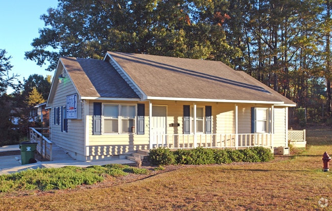
Property Record
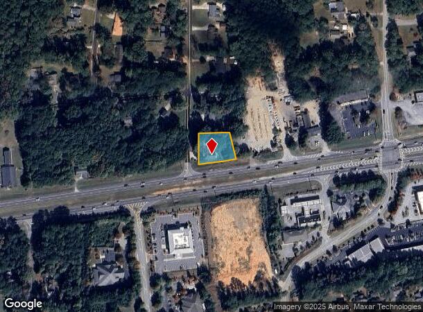
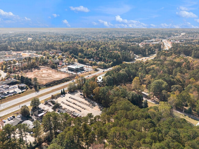
2180 Highway 34 E, Newnan, GA 30265

Current Lease Availabilities
NEARBY LISTINGS FOR SALE OR LEASE
Property Detail
2180 Highway 34 E
Atlanta-Sandy Springs-Roswell, GA
Eastwood Estates
109A-055
OFFICE/LT EAST WOOD EST
Officebuilding
Coweta
X
Georgia
13077C0164D
5
2025
0.53 AC
2025
Fayette/Coweta County
170310
Atlanta
1,521 SF
DEMOGRAPHICS near 2180 Highway 34 E
1 Mile
3 Mile
5 Mile
2024 Total Population
2,390
28,398
70,970
2029 Population
2,625
31,538
78,958
Pop Growth 2024-2029
+ 9.83%
+ 11.06%
+ 11.26%
Average Age
45
41
40
2024 Total Households
942
10,816
26,786
HH Growth 2024-2029
+ 9.77%
+ 11.11%
+ 11.30%
Median Household Inc
$102,446
$93,794
$89,491
Avg Household Size
2.50
2.60
2.60
2024 Avg HH Vehicles
2.00
2.00
2.00
Median Home Value
$261,565
$267,138
$279,737
Median Year Built
1996
1998
1999
Nearby Places
Map Layers
Map Styles
 Street
 Aerial
- Restaurants
- Banks
- Shops
- Fitness
- Groceries
PUBLIC TRANSPORTATION
AIRPORT
Hartsfield - Jackson Atlanta International
DRIVE
WALK
Distance
Hartsfield - Jackson Atlanta International
39 min
28.4 mi
Nearby Properties
Address
Land Use
TOTAL SIZE
Lot Size
Zoning
Address
Land Use
TOTAL SIZE
Lot Size
Zoning
1,001,000 SF
118.56 AC
R1
Address
Land Use
TOTAL SIZE
Lot Size
Zoning
1,955,650 SF
101.74 AC
M
Address
Land Use
TOTAL SIZE
Lot Size
Zoning
1,079,000 SF
73.44 AC
M
Address
Land Use
TOTAL SIZE
Lot Size
Zoning
1,206,927 SF
109.06 AC
R1
Address
Land Use
TOTAL SIZE
Lot Size
Zoning
1,206,927 SF
109.06 AC
R1
Address
Land Use
TOTAL SIZE
Lot Size
Zoning
395,621 SF
35.51 AC
001
Address
Land Use
TOTAL SIZE
Lot Size
Zoning
403,472 SF
61.64 AC
M
Address
Land Use
TOTAL SIZE
Lot Size
Zoning
196,093 SF
17.31 AC
002
Address
Land Use
TOTAL SIZE
Lot Size
Zoning
446,159 SF
49.05 AC
M
Address
Land Use
TOTAL SIZE
Lot Size
Zoning
770,898 SF
215.23 AC
M
Address
Land Use
TOTAL SIZE
Lot Size
Zoning
367,120 SF
28.64 AC
M
Address
Land Use
TOTAL SIZE
Lot Size
Zoning
457,922 SF
45.16 AC
R1
Address
Land Use
TOTAL SIZE
Lot Size
Zoning
102,007 SF
18.92 AC
002
Address
Land Use
TOTAL SIZE
Lot Size
Zoning
215,344 SF
28.12 AC
R1
Address
Land Use
TOTAL SIZE
Lot Size
Zoning
299,520 SF
32.45 AC
R1
Address
Land Use
TOTAL SIZE
Lot Size
Zoning
109,692 SF
10.94 AC
ND
Address
Land Use
TOTAL SIZE
Lot Size
Zoning
117,354 SF
48.81 AC
ND
Address
Land Use
TOTAL SIZE
Lot Size
Zoning
162,627 SF
18.96 AC
M
Address
Land Use
TOTAL SIZE
Lot Size
Zoning
134,417 SF
13.01 AC
R1
Address
Land Use
TOTAL SIZE
Lot Size
Zoning
216,250 SF
20.12 AC
R1
Address
Land Use
TOTAL SIZE
Lot Size
Zoning
92,067 SF
7.18 AC
001
Address
Land Use
TOTAL SIZE
Lot Size
Zoning
108,138 SF
6.36 AC
002
Address
Land Use
TOTAL SIZE
Lot Size
Zoning
90,675 SF
20.42 AC
001
Address
Land Use
TOTAL SIZE
Lot Size
Zoning
71,888 SF
23.48 AC
R1
Address
Land Use
TOTAL SIZE
Lot Size
Zoning
105,900 SF
12.35 AC
M
Address
Land Use
TOTAL SIZE
Lot Size
Zoning
153,943 SF
16.20 AC
ND
Address
Land Use
TOTAL SIZE
Lot Size
Zoning
70,162 SF
12.32 AC
001
Address
Land Use
TOTAL SIZE
Lot Size
Zoning
47,598 SF
4.29 AC
C
Address
Land Use
TOTAL SIZE
Lot Size
Zoning
131,541 SF
19.23 AC
ND
Address
Land Use
TOTAL SIZE
Lot Size
Zoning
121,290 SF
11.74 AC
R1
The World's #1 Commercial Real Estate Marketplace
Connect with us
© 2025 CoStar Group
The information above has been obtained from sources believed reliable. While we do not doubt its accuracy we have not verified it and make no guarantee, warranty or representation about it. It is your responsibility to independently confirm its accuracy and completeness. Any projections, opinions, assumptions, or estimates used are for example only and do not represent the current or future performance of the property. The value of this transaction to you depends on tax and other factors which should be evaluated by your tax, financial, and legal advisors. You and your advisors should conduct a careful, independent investigation of the property to determine to your satisfaction the suitability of the property for your needs.